The Santa Ana volcano, known by its Nahuat name Ilamatepec, is the highest volcano in El Salvador, its rim rising to a little over 2,300 metres above sea level. It sits in the middle of the western highlands, with the city of Santa Ana to the north, Lake Coatepeque to the east and the young cone of Izalco just to the south. Climbing it is the best known hike in the country, and with good reason: you walk up from the cloud forest of the Cerro Verde area onto bare volcanic slopes and finally look down into a deep crater with an acid lake at the bottom.
This guide covers the climb in general terms. Departure arrangements, fees and rules change, so check before you go, but the shape of the day stays much the same.
The volcano and the park
Ilamatepec is part of the Los Volcanes National Park, the protected area that also covers Cerro Verde and Izalco. The three volcanoes stand close together: Cerro Verde, an old, forested and long extinct cone; Izalco, a bare dark cone born in the eighteenth century; and Santa Ana, the giant of the group, a broad stratovolcano whose summit holds a series of nested craters.
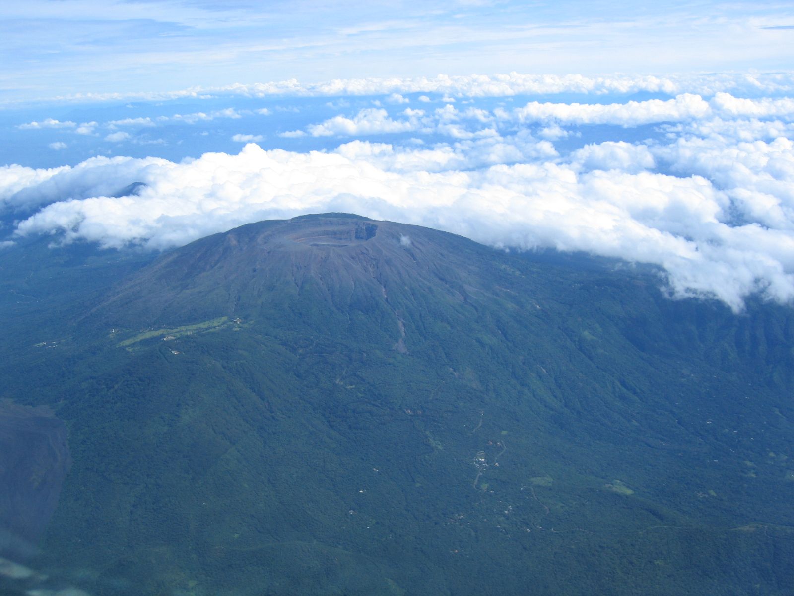
Seen from the air, the summit is a wide bowl with a smaller, deeper crater inside it. The volcano has been active through recorded history, and its most recent significant eruption, on 1 October 2005, threw out ash and rocks and sent mudflows down the slopes, causing deaths and damage in nearby communities. Since then the crater has been watched closely by the authorities, and access to the summit can be closed when activity rises. That is one of the reasons to check current conditions before you go.
How the climb works
The hike normally starts from the area around the Cerro Verde park entrance, high on the shoulder between the volcanoes. Visitors climb in groups with a park guide, and in recent years police officers have often accompanied the groups. Departures are organised at set times of day rather than whenever you arrive, and there are fees for the park and the guide; times, fees and arrangements change, so confirm them shortly before your visit.
The route begins on a trail through forest, drops a little, then crosses farmland and scrub before climbing onto the open upper slopes. The last section is on loose volcanic gravel and rock with little shade, and it is steep in places. Most reasonably fit walkers manage it without difficulty, but it is a proper hike with real height gain, and the altitude makes itself felt if you have come straight from the coast. Take it slowly, drink often and stop when you need to.
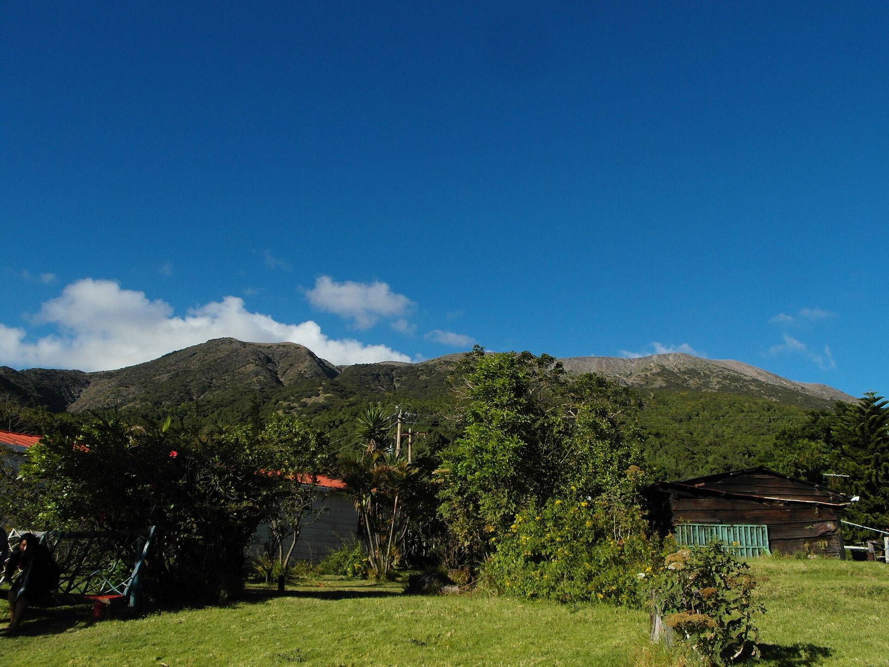
Along the way the vegetation tells you how high you are. Near the start there are tall trees, ferns and moss, much like the cloud forest on Cerro Verde. Higher up the trees thin into scrub, agaves and low bushes that cope with wind and thin soil, and near the top there is little but bare grey ash and rock. Birds are common in the lower forest, and in the early morning you may hear more than you see.
On a clear morning the views open up as you climb: Izalco's dark cone below you, Lake Coatepeque filling its caldera to the east, the coffee hills rolling away toward the Ruta de las Flores and, on the clearest days, a line of the Pacific in the distance.
The crater lake
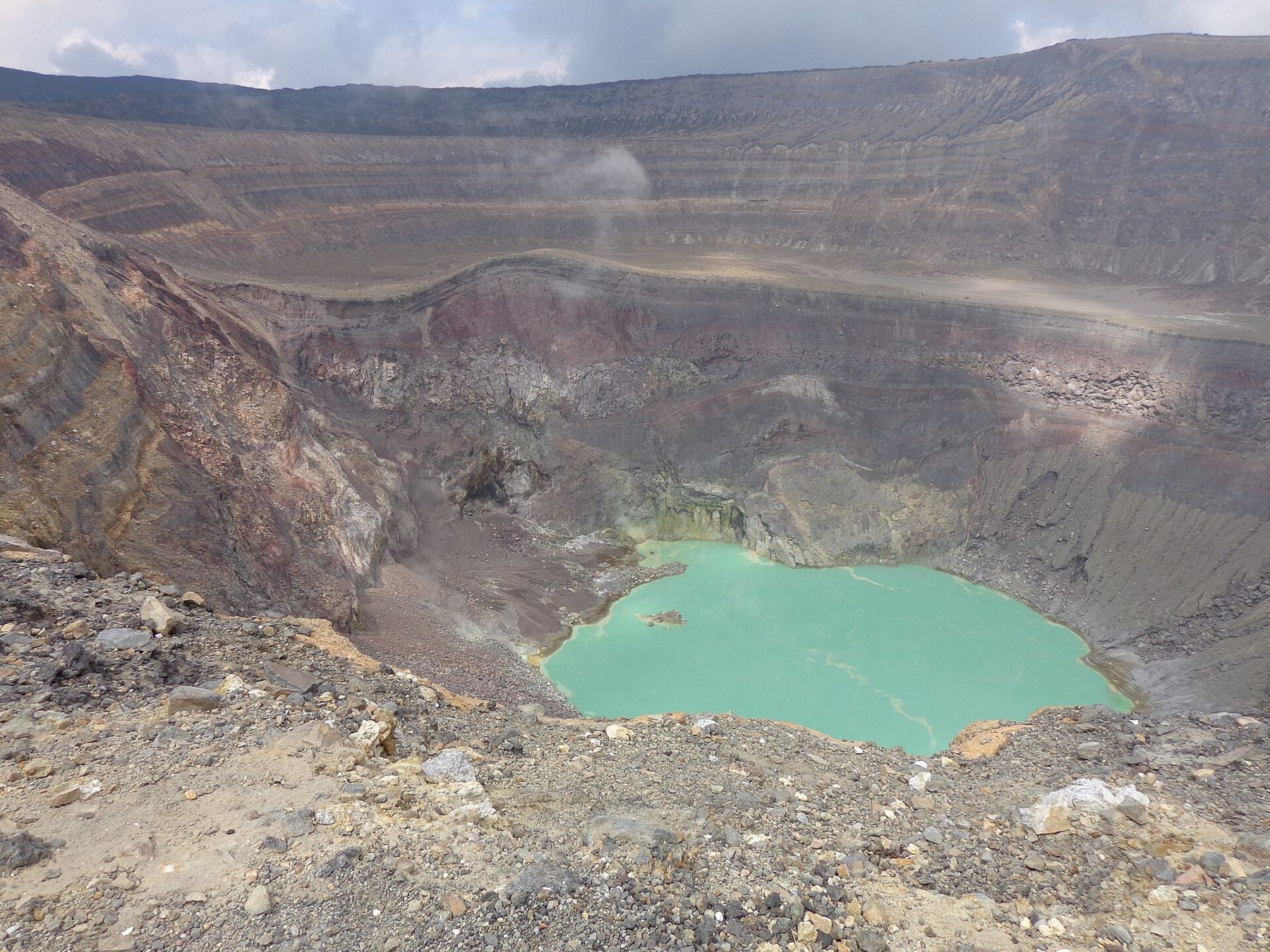
At the rim the ground falls away into the crater. The walls are banded in grey, red, yellow and brown, layers of ash and lava laid down over many eruptions, and at the bottom lies a small lake of startling green or turquoise. The colour comes from the volcanic water itself, which is strongly acidic and loaded with dissolved minerals and sulphur. Steam drifts off the surface and from vents on the walls, and the smell of sulphur reaches the rim when the wind is right.
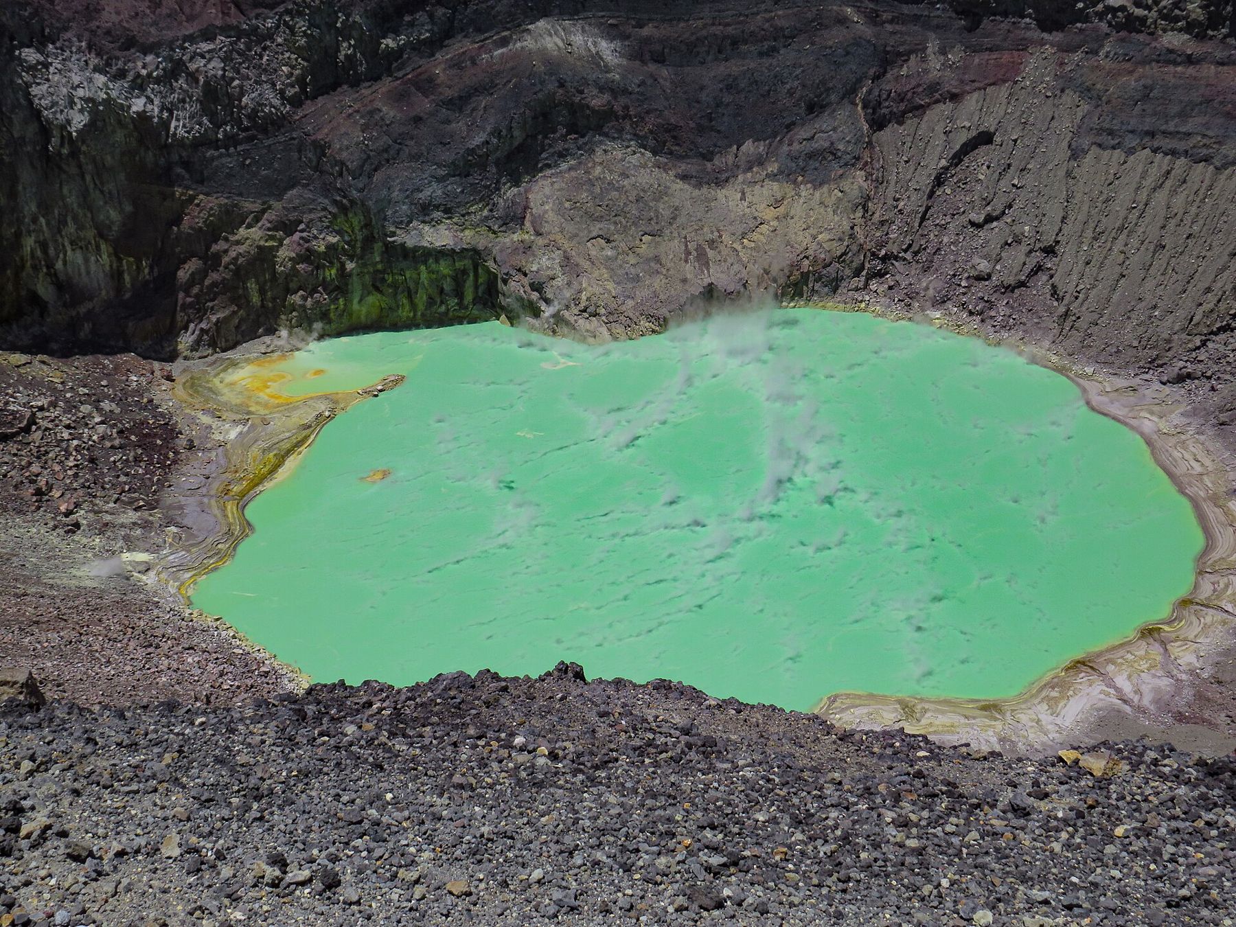
Lakes like this form when rain collects in a crater above a hot volcanic system. Gases rising from below dissolve in the water and turn it acidic, and the lake's level, temperature and colour rise and fall with the activity underneath. Scientists watch the lake for exactly that reason: changes in it can be an early sign that the volcano is stirring.
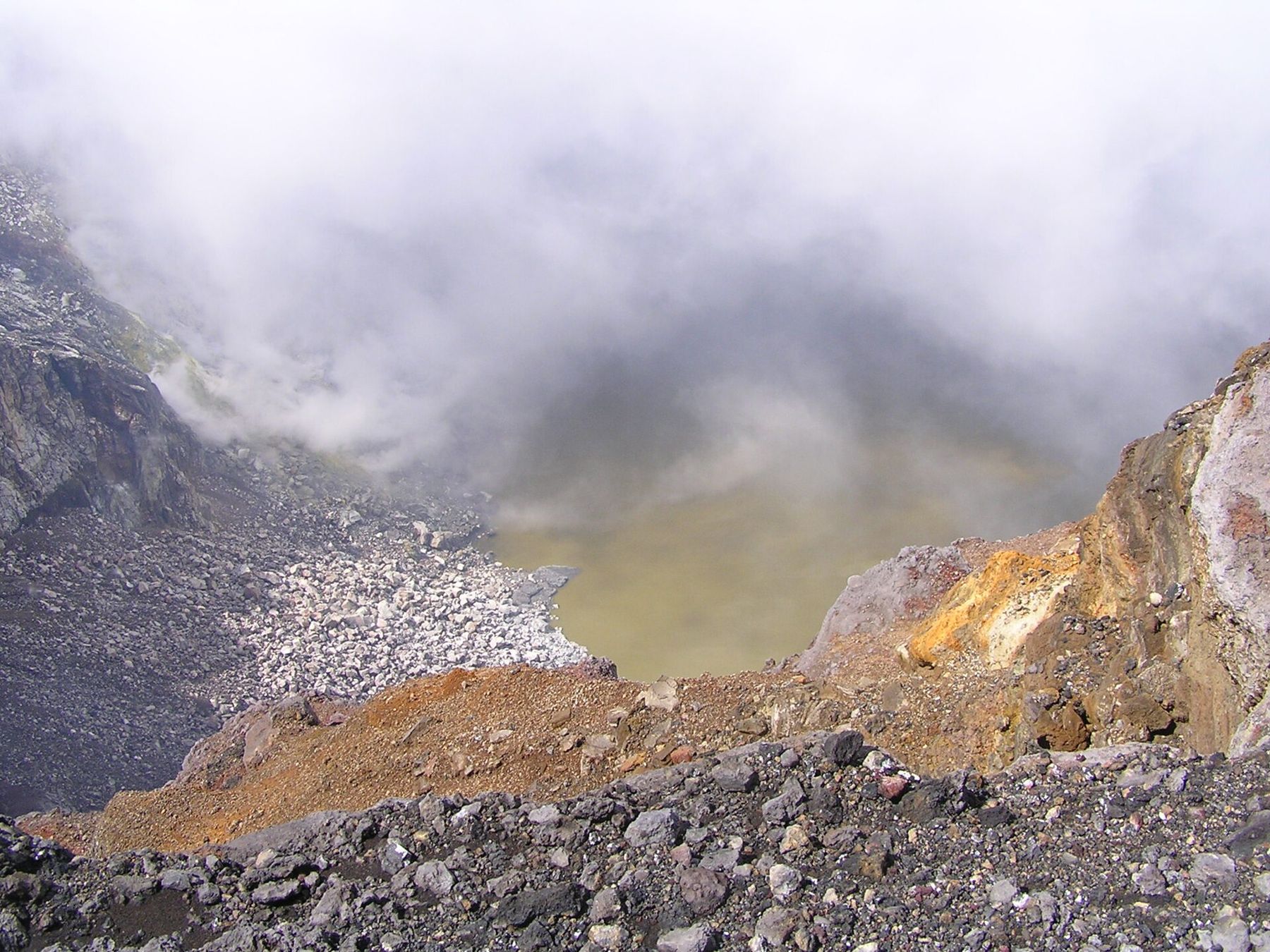
The lake changes from visit to visit. Some days it is bright green, others milky blue or grey, and when cloud fills the crater you may see nothing at all for a while before it clears. Do not try to go down into the crater, and stay back from the edge: the rim is made of loose material and the gases rising from the lake are not something to breathe up close. Follow the guide's instructions about where to stand.
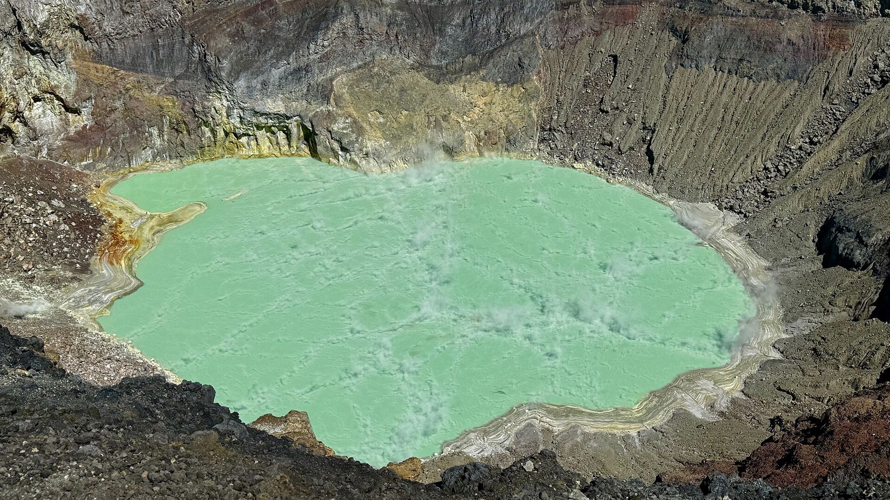
The walls are banded in grey, red, yellow and brown, layers of ash and lava laid down over many eruptions, and at the bottom lies a small lake of startling green or turquoise.
What to bring and when to go
The dry season, roughly November to April, gives the best chance of clear views and dry trails. In the rainy season, roughly May to October, mornings are often fine but cloud and storms tend to build by midday, so an early group is the better choice whenever you go. It is much cooler at the top than in Santa Ana or on the coast, and it can be windy and cold at the rim even when the sun is strong.
- Plenty of water, as there is none on the trail
- Snacks or a packed lunch
- A sun hat and sunscreen; there is almost no shade on the upper slopes
- A warm layer and a light rain jacket
- Shoes with good grip for the loose gravel
- Small US dollar notes for fees
Getting there
The Cerro Verde area is reached by a winding road that climbs from the highway between Santa Ana and Sonsonate. With a car it is a fairly straightforward drive from Santa Ana; by bus there are services from the city toward the park, though routes and timetables change and connections may be limited, so check them in advance and allow plenty of time. The page on getting around the west has more on buses and driving. Conditions in El Salvador have changed a great deal in recent years; check current official advice before you travel, and confirm that the summit is open.
Many people combine the climb with a visit to Cerro Verde's cloud forest trails and the viewpoints over Izalco, or with an afternoon at Lake Coatepeque, which lies below the volcano's eastern flank. After a morning on the volcano, a swim in the lake or a slow lunch in Santa Ana feels well earned.
Coffee note
The lower slopes of Ilamatepec are coffee country. On the drive up, shaded fincas give way to pine and scrub only near the trailhead.